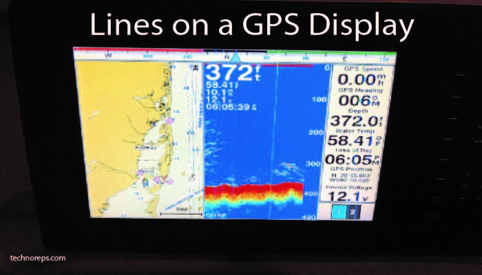
Navigating the World: A Comprehensive Exploration of Lines on a GPS Display
In our modern era, navigation has become an integral part of our daily lives, thanks to the ubiquitous Global Positioning System (GPS). At the heart of every GPS device is a display adorned with lines that guide us through unknown terrain. In this article, we delve into the intricacies of these lines on a GPS display, examining their types, functions, and the technology that makes them an indispensable tool for navigation.
The Basics: Understanding the Coordinate Lines
At the core of any GPS display are the coordinate lines that form a grid, providing users with a precise location on the Earth’s surface. These lines, namely latitude and longitude, intersect to create a network that divides the globe into manageable units. Understanding how these lines work is fundamental to grasping the essence of GPS navigation.
Latitude Lines: Horizontally Mapping the Earth
Latitude lines, also known as parallels, run parallel to the equator and measure the distance north or south of this imaginary line. The equator itself represents 0 degrees latitude, with lines extending up to 90 degrees north and 90 degrees south. These lines play a crucial role in determining one’s position on a north-south axis.
Longitude Lines: The Vertical Grid of Navigation
Longitude lines, or meridians, intersect latitude lines at right angles, creating a grid that covers the Earth’s surface. The prime meridian, located at 0 degrees longitude, serves as the reference point from which lines extend to 180 degrees east and 180 degrees west. Longitude lines aid in pinpointing locations on an east-west axis.
The Intersection: Locating Your Position
The intersection of latitude and longitude lines represents a unique geographical coordinate, enabling GPS devices to pinpoint an exact location. This intersection serves as the basis for navigation, guiding users to their destination with remarkable accuracy.
Routes and Tracks: Lines in Motion
Beyond static coordinates, GPS displays often feature dynamic lines representing routes and tracks. Routes outline a predetermined path from one point to another, guiding users along a specific course. Tracks, on the other hand, record the actual path traveled, allowing users to retrace their steps or analyze their journey later.
Waypoints: Marking Significant Points
Waypoints are specific locations marked on a GPS display, often denoted by symbols or icons. These serve as reference points for navigation, helping users navigate to and from important locations. Waypoints can represent anything from a scenic viewpoint to a crucial turn in a hiking trail.
Bearing Lines: Navigating in the Right Direction
Bearing lines are directional indicators that guide users toward a specific waypoint or destination. These lines, often accompanied by distance measurements, help travelers stay on course and reach their intended location efficiently. Understanding bearing lines is essential for effective navigation in various environments.
Topographic Lines: Understanding the Terrain
In addition to traditional coordinate lines, GPS displays in advanced systems often incorporate topographic lines. These lines represent elevation contours, offering a visual representation of the terrain. Hikers, mountaineers, and outdoor enthusiasts benefit from these lines, gaining insights into the steepness and layout of the landscape.
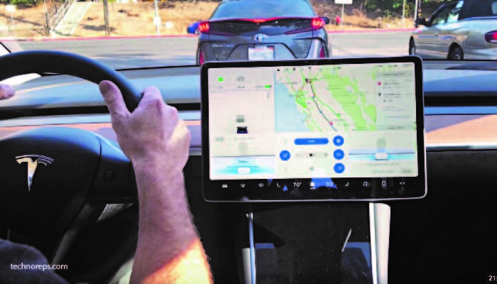
Advanced Navigation Features: 3D Maps and Augmented Reality
Modern GPS displays go beyond basic lines, incorporating advanced features like 3D maps and augmented reality. 3D maps provide a realistic depiction of the terrain, enhancing the user’s spatial awareness. Augmented reality overlays digital information onto the real-world view, creating an immersive navigation experience.
Challenges and Limitations: When Lines Aren’t Enough
While GPS technology has revolutionized navigation, it is not without its challenges. Signal loss in urban canyons, dense forests, or mountainous regions can impact the accuracy of GPS readings. Understanding these limitations is crucial for users who rely heavily on GPS navigation.
The Future of Navigation: Beyond Lines on a Screen
As technology continues to advance, the future of navigation holds exciting possibilities. Emerging technologies, such as quantum positioning systems and improved satellite constellations, promise even greater accuracy and reliability in navigation. The lines on a GPS display represent just the beginning of a continually evolving field.
Conclusion
In conclusion, the lines on a GPS display are not mere abstract markings; they are the visual representation of a complex system that has transformed how we navigate the world. From the basic coordinate lines of latitude and longitude to the dynamic routes, tracks, and waypoints, each line serves a specific purpose in guiding us through the vast landscapes of our planet. As we embrace the advanced features and emerging technologies in navigation, the lines on a GPS display continue to be an indispensable tool, opening up new horizons and ensuring that we can confidently navigate our way through the complexities of our interconnected world.